James (Jake) Gearon's Research Home
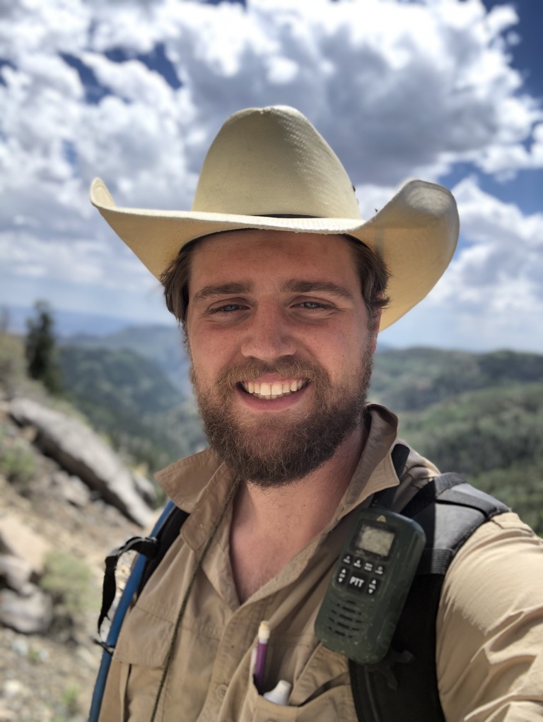
First-year PhD student at Indiana University | Advised by Douglas Edmonds| Edmonds Group jhgearon@iu.edu
A Sedimentologist focused on constraining morphology, sedimentary dynamics, depositional architectures, and sediment-water interfaces in the modern and ancient using remote sensing, data analytics, and old-fashioned field work
My CV
Departmental Bio
My Twitter
My LinkedIn Profile
Current Projects
This page is a work in progress and is updated continously, thanks for visiting! -JG
Update
- I will be attending AGU 2021 in New Orleans!
- I’ve started my Ph.D work at Indiana University with Professor Doug Edmonds.
Sedimentology
Master’s Project | The Supply-Generated Sequence: A New Sequence-Stratigraphic Model for Fluvio-Lacustrine Deposits
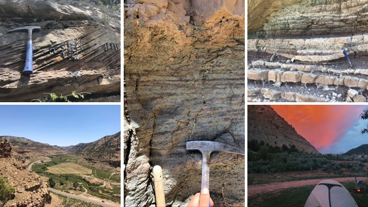 Project description: An outcrop-based, near depositional-strike cross section of Uinta Basin fluvio-lacustrine interactions along the well-studied Nine Mile Canyon near Helper, Utah, highlights the strike variability of facies and depositional environments in the Sunnyside Interval deposits. A new, high-resolution correlation panel demonstrates the usefulness of a new lacustrine sequence stratigraphic concept: the Supply-Generated Sequence (SGS). This allows subdivision of the cyclically deposited fluvial and lacustrine facies in the Sunnyside Interval based on identifiable stratigraphic horizons, interpreted in terms of marked clastic input followed by subaqueous lake encroachment, addressing an inadequacy of previous sequence stratigraphic interpretations of the Sunnyside Interval. Conventional interpretations rely on premises regarding base level and sediment discharge that were developed for marine settings and do not apply directly to lacustrine settings. In lacustrine systems, accommodation as well as sediment-supply are generated by water and sediment discharge routed through tributary rivers, making pulses of deposition inherently transgressive in nature. Our findings corroborate recent studies that consider the large, channelized sandstone deposits (shown to be accompanied by 13C negative excursions) of the Sunnyside Interval to be discharge macroforms deposited during orbitally forced high-discharge early Eocene Hyperthermal events that lasted ~40 kyr. We document lateral complexity and discontinuity of the large, sandstone event deposits with SGS durations of ca. 40-50 kyr, adding further evidence for the hyperthermal forcing mechanism model. Ultimately, we characterize the Sunnyside Interval System as a terminal “Supply-Controlled Splay Delta” with high sediment and water supply during transitory hyperthermal events and low sediment and water supply during the inter-hyperthermal periods.
Remote Sensing
Earth Science Information Partners (ESIP) Winter 2020 Grant (PI): Creating a Public Database of Global Lake Water
Levels
 Project description: There are many publicly available lake-level data sets in varying states of accessibility
, upkeep, and accuracy (USGS, HydroWeb, Copernicus Global Land Service, NASA, NOAA, and various publications). The
collating of data from disparate sources, or data-wrangling, is often the barrier to entry for many scienific
projects. Lake water level data particularly suffers from lack of ease of access as it is distributed haphazardly
across federal, state, and academic databases. ESIP, AWS, and I have collaborated to provide an open-source, well
documented, scalable, modular, and regularly updated database of lake water levels and a python package LakePy of
which acts as a pythonic wrapper for the Global Lake Level Database API. Removing hurdles between researchers and
available data is imperative in an increasingly data-rich world. Many researchers have immense subject-matter expertise regarding the biological, hydrological, and sedimentological nuances of lacustrine environments but little or no experience in automated querying, data cleaning/wrangling, or programming.
Project description: There are many publicly available lake-level data sets in varying states of accessibility
, upkeep, and accuracy (USGS, HydroWeb, Copernicus Global Land Service, NASA, NOAA, and various publications). The
collating of data from disparate sources, or data-wrangling, is often the barrier to entry for many scienific
projects. Lake water level data particularly suffers from lack of ease of access as it is distributed haphazardly
across federal, state, and academic databases. ESIP, AWS, and I have collaborated to provide an open-source, well
documented, scalable, modular, and regularly updated database of lake water levels and a python package LakePy of
which acts as a pythonic wrapper for the Global Lake Level Database API. Removing hurdles between researchers and
available data is imperative in an increasingly data-rich world. Many researchers have immense subject-matter expertise regarding the biological, hydrological, and sedimentological nuances of lacustrine environments but little or no experience in automated querying, data cleaning/wrangling, or programming.
This work is based on funding provided by the ESIP Lab with support from the National Aeronautics and Space Administration (NASA), National Oceanic and Atmospheric Administration (NOAA) and the United States Geologic Survey (USGS).
See the funded proposal here
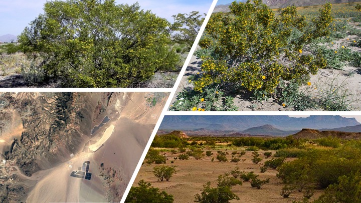
Geomorphic Controls on Shrub Canopy Size and Spacing of Creosote Bush in Northern Mojave Desert, USA
 This manuscript has been published in (Landscape Ecology) and is available here. For a 1-page summary, click here
Project Abstract
Context - Studies on the role of geomorphology on vegetation structure at the basin scale are rarely available
and less likely in the future due to access, funding, and potential health risks.
Objectives - Our goal is to determine the primary abiotic controlling factor(s) on shrub canopy structure using a dataset of approximately 23 million individual shrubs, generated using remote sensing and ground-truthing by Young et al. (2017, doi:10.3390/rs9050458). We posit that landscape position and local-scale geomorphic features in a desert alluvial fan environment will influence canopy volume and shrub spacing of creosote bush Larrea tridentata.
Methods - We relate selected characteristics (canopy volume and spatial distribution) of identified L. tridentata to aspect and surface geomorphology at each shrub location. Statistical analyses included K-S testing, distribution fitting, and several generalized linear models (GLMs). The study was located in Eldorado Valley, Nevada, USA.
Results - Aspect and surface age have demonstrable influences on both shrub canopy volume and shrub spacing for
all 5 geomorphic surfaces studied, with the highest median canopy volumes on east-facing surface (0.758m3) almost 5X
larger than the lowest median volumes (0.152m3) on the WNW-facing surfaces; variability in shrub volume was also
higher on east-facing than west-facing surfaces. Shrub spacing on alluvial flat and fan skirt surfaces (2.418 and
2.333m, respectively) were larger than older alluvial fan, fan piedmont and fan remnant surfaces (1.776, 1.837 and 1.892m, respectively). Results show a significant relationship between spacing and canopy volume by aspect and by geomorphic surface.
Conclusions – Results show a significant relationship between shrub spacing and canopy volume by aspect and geomorphic surface, indicating a threshold at which biotic effects on canopy structure from intra-species competition transition to abiotic effects governed by geomorphic and climatological factors.
Page template forked from evanca